- By Dan Veaner
- Around Town
 Print
Print
A small group of interested souls braved the rain Saturday to take a walking tour of Salt Point and learn about changes that will be made when the Town begins transforming the facility. Salt Point is an area on the north side of Salmon Creek, across the creek from from Myers Park. The DEC has granted the Town of Lansing a 25 year lease to manage the property. "At this point I think they're pretty happy with what's going on," says Town Supervisor Steve Farkas. "This has been a sore thumb for them for a while, and it's going to take a big load off of their back that we're willing to take this on."
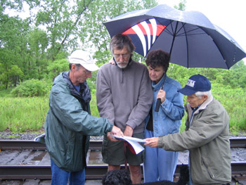
Bob McGuire (left) explains planned improvements
for Salt Point
According to Farkas the DEC hasn't had the resources to effectively manage the area since they purchased it from International Salt in the early 1960s. The Town negotiated with the DEC to take over management of the property, which has deteriorated due to erosion and misuse.
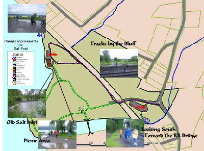
Vehicular access will be limited with one access road
and two parking lots. A picnic area, walking trails,
informational kiosks, and natural plantings are planned.
With a grant for materials and labor from the Town Highway Department and volunteers, the Town will meet DEC goals for the area and create a place where residents can study nature, walk dogs, canoe and kayak, picnic, walk, hunt, fish and learn about the environment.
The tour was conducted by Town of Lansing Environmental Planner Darby Kiley and Robert (Bob) McGuire, Project Coordinator. It allowed people to see for themselves what changes will be made once the NYS Department of Environmental Conservation approves the final draft of the management plan they developed. That plan is currently in the DEC's hands and is expected to be approved now that the public comment period has passed. "We've had very good relations with the DEC in Cortland," McGuire says. "They've been very responsive." The group gathered by the parking area just north of the bridge off of Myers Road. McGuire began by handing out a map of proposed improvements and lists of action items and passive use recreation activities that will be allowed.
"It's a big piece of the Town of Lansing's early history," McGuire told the group. Originally the point was a hunting and fishing ground for the Cayuga Tribe of Iroquois. Cayuga Lake Salt Company operated a plant on the site from 1893 to 1962, starting with 100 employees processing 140 tons daily. Deep wells were used to extract brine which was evaporated to yield the salt. The barge canal system and railroad was used to transport the salt.
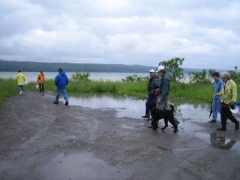
The picnic area will be here
In the 1960s DEC purchased the land and opened it for public access. They operated a fish hatchery there for about ten years in the 1970s. Since the 1980s the area was functionally abandoned, leaving it open for recreational activities, both legal and illegal. Dirt roads are significantly pocked by potholes, and despite periodic cleanup efforts by volunteers, dumping has been rampant. Unleashed pets and their waste, unauthorized boat launching, bonfires, partying and alcohol consumption have also gone unchecked. Under the lease the Town will now regulate Salt Point. "We've already talked with our constable, and when he's at the park he'll come over here," Farkas says.
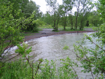
Salt was shipped out of this small inlet by barge
In the future the Town hopes to get a grant to build a footbridge between Myers Park and Salt Point. The general idea is that Myers Park is an active use park, while Salt Point will be a passive use one. Farkas says it will be "a quiet place" for residents and visitors to enjoy.
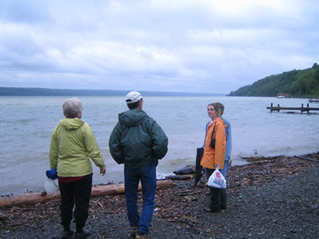
Darby Kiley (orange coat) explains the management plan
Paved roads and parking areas will be established that go from the current entrance along the railroad tracks to the lake, where a smaller parking lot and picnic area will be placed. The current dirt roads will be eliminated, replaced by walking trails where hunters, birders and nature lovers can go on foot. Vehicular access will be limited, and a gate will close the park at night. Informational kiosks will be placed in the two parking areas. Invasive plants will be identified and removed, and reed beds will be established along the lakefront.
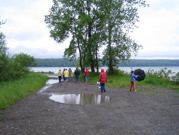
Farkas says enforcement will be aggressive at first to get people used to new regulations as well as enforcement of existing laws such as Lansing's dog control law. He says that additional funding may be available for the project, because it is a perfect stop-over place for the Erie Canal program, which is looking for stops along their route.
McGuire noted that may residents are confused about the location. "The folks that just came in, I just heard them saying, 'We thought Salt Point is down where the salt company is now," he said Saturday. "One of the things we've been trying to do is get the word out that this area is to be called Salt Point." As the management plan is implemented, the word will be out.
----
v2i22

Bob McGuire (left) explains planned improvements
for Salt Point
According to Farkas the DEC hasn't had the resources to effectively manage the area since they purchased it from International Salt in the early 1960s. The Town negotiated with the DEC to take over management of the property, which has deteriorated due to erosion and misuse.

Vehicular access will be limited with one access road
and two parking lots. A picnic area, walking trails,
informational kiosks, and natural plantings are planned.
With a grant for materials and labor from the Town Highway Department and volunteers, the Town will meet DEC goals for the area and create a place where residents can study nature, walk dogs, canoe and kayak, picnic, walk, hunt, fish and learn about the environment.
The tour was conducted by Town of Lansing Environmental Planner Darby Kiley and Robert (Bob) McGuire, Project Coordinator. It allowed people to see for themselves what changes will be made once the NYS Department of Environmental Conservation approves the final draft of the management plan they developed. That plan is currently in the DEC's hands and is expected to be approved now that the public comment period has passed. "We've had very good relations with the DEC in Cortland," McGuire says. "They've been very responsive." The group gathered by the parking area just north of the bridge off of Myers Road. McGuire began by handing out a map of proposed improvements and lists of action items and passive use recreation activities that will be allowed.
Visitors touring Salt Point saw close up what can happen when a natural area is not monitored. Norfolk Southern Railroad, which has a right of way through Salt Point, diverted storm water by digging a new stream from the bluff almost to Salmon Creek. Water was diverted through culverts under the tracks, but these tended to flood, causing it to flow over railroad tracks in what Bob McGuire called an 'environmental rape' as he showed the damage to residents touring the parkland. 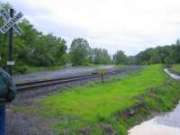 Culverts under tracks (left) weren't adequate, so the railroad cut a long stream (right) that forces water into Salmon Creek Without seeking approval or permits, the railroad cut a swath along the tracks, almost to Salmon Creek. Water flows into a large puddle, which overflows and then goes into the creek. Evidently DEC wants the land restored to its original configuration and is in negotiation with the railroad to find an alternative solution. The water diversion goes beyond the railroad's right of way into land the Town now manages, and railroad workers also left a large pile of stone on Town-managed land. |
"It's a big piece of the Town of Lansing's early history," McGuire told the group. Originally the point was a hunting and fishing ground for the Cayuga Tribe of Iroquois. Cayuga Lake Salt Company operated a plant on the site from 1893 to 1962, starting with 100 employees processing 140 tons daily. Deep wells were used to extract brine which was evaporated to yield the salt. The barge canal system and railroad was used to transport the salt.

The picnic area will be here
In the 1960s DEC purchased the land and opened it for public access. They operated a fish hatchery there for about ten years in the 1970s. Since the 1980s the area was functionally abandoned, leaving it open for recreational activities, both legal and illegal. Dirt roads are significantly pocked by potholes, and despite periodic cleanup efforts by volunteers, dumping has been rampant. Unleashed pets and their waste, unauthorized boat launching, bonfires, partying and alcohol consumption have also gone unchecked. Under the lease the Town will now regulate Salt Point. "We've already talked with our constable, and when he's at the park he'll come over here," Farkas says.

Salt was shipped out of this small inlet by barge
In the future the Town hopes to get a grant to build a footbridge between Myers Park and Salt Point. The general idea is that Myers Park is an active use park, while Salt Point will be a passive use one. Farkas says it will be "a quiet place" for residents and visitors to enjoy.

Darby Kiley (orange coat) explains the management plan
Paved roads and parking areas will be established that go from the current entrance along the railroad tracks to the lake, where a smaller parking lot and picnic area will be placed. The current dirt roads will be eliminated, replaced by walking trails where hunters, birders and nature lovers can go on foot. Vehicular access will be limited, and a gate will close the park at night. Informational kiosks will be placed in the two parking areas. Invasive plants will be identified and removed, and reed beds will be established along the lakefront.

Farkas says enforcement will be aggressive at first to get people used to new regulations as well as enforcement of existing laws such as Lansing's dog control law. He says that additional funding may be available for the project, because it is a perfect stop-over place for the Erie Canal program, which is looking for stops along their route.
McGuire noted that may residents are confused about the location. "The folks that just came in, I just heard them saying, 'We thought Salt Point is down where the salt company is now," he said Saturday. "One of the things we've been trying to do is get the word out that this area is to be called Salt Point." As the management plan is implemented, the word will be out.
----
v2i22


